
Duration: 2.5-5 hours
Distance (one-way and round trip): approximately 3.5 miles from Roger C. Fisher Park to Ed Koch Access Area; it is an additional 3.5 miles to Phillips Landing.
Starting Location: Roger C. Fisher Laurel River Park
Latitude: 38.557100
Longitude:-75.575950
Town of Laurel Website | DE Fish & Wildlife
Difficulty: Beginner/Intermediate
As with many towns in the Nanticoke River region, time and tide are closely connected in the town of Laurel. Up-creek from Bethel, Laurel served as a terminus for a number of industries. Ships often traveled between the Broad Creek towns, as lumber was a valuable commodity for ship-building enterprises. Ships continued to haul goods into Laurel for many years, and while Broad Creek is no longer a working creek, you can follow the path that many schooners took in years past. From Laurel, you can paddle to just below Bethel or go a few more miles and end at Phillips Landing, near the confluence with the Nanticoke River. You can find out more about these two towns and their histories at their respective historical societies (Laurel Historical Society | Bethel Historical Society + Maritime Museum).
Broad Creek turns tidal in Laurel, so check the tide charts before departing. Paddling with the tide is recommended and will make for an easier, more pleasant journey. In Laurel, Broad Creek is fairly narrow and trees buffer the shorelines. While you may see a fisherman or two in a motorboat, they are usually moving at a very slow speed. However, as you move further west, the creek will widen and you will encounter more motorboats. Broad Creek is a very well-known largemouth bass fishery, and bass fishing tournaments do occur on this waterway. As you may expect, weekends during the summer are the busiest times, so if you’re able, we recommend paddling on a weekday.
OPTIONAL STOP 1: Before leaving Laurel, head upstream a short distance to the railroad bridge. This is the site of a unique disaster–the crashing of a Norfolk Express engine with a schooner, the Golden Gate, in 1904. The engineer lost his life, but all others were able to make their ways safely back to shore. Although the drawbridge is obviously newer, the stone supports were in place during this event. Charlie Ipcar wrote a song about this tragedy; read the lyrics at his page.
Head west or downstream from Roger C. Fisher Laurel River Park. In the first half of the Fisher Park to Ed Koch paddle, you will paddle through heavily forested areas that provide shade. Large baldcypress and sycamore trees dominate the landscape, although smaller shrubs like sweet pepperbush and swamp roses dot the landscape. Dragonflies dart across the water, and bees and other pollinators can be viewed at any of the blooming flowers you see. If you’re quiet enough, you may spot a beaver and river otter near the shoreline. Songbirds are also concentrated in this area. You may see or hear Baltimore Orioles, a number of warblers, and common birds such as Carolina Wrens, Cardinals, and Osprey.
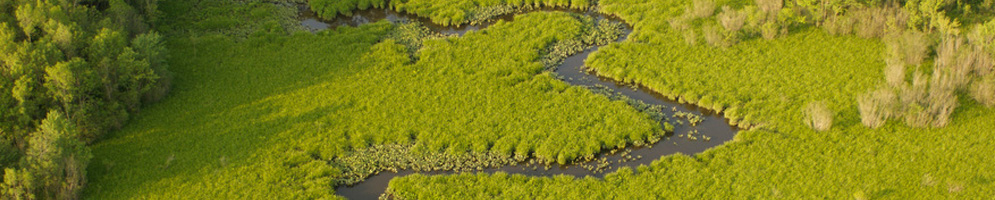
In the second half of the paddle, you’ll enter more open water and have the potential to paddle through lilypads, tuckahoe or arrow arum, and pickerel weed and its lavender flowers. Keep an eye (and ear) open for the rat-a-tat-tat of Belted Kingfishers as they zip over the water. Osprey will also be active on this part of the river. There is a nest in Bethel; look for another on daymark 14.
As you approach Bethel, you’ll see a lagoon and a sign. This is Bethel Hole, and it’s a protected largemouth bass nursery. No fishing is permitted from April 1 through June 30. Barn swallows will fly overhead as you pass beneath the tall bridge and enter Bethel. Unfortunately, there’s nowhere to put out in Bethel, but you may want to visit the Bethel Market for a sandwich or ice cream after your paddle and walk around the historic ship-building town.
Once you depart Bethel, a short paddle remains to reach Ed Koch Access Area. The area is not marked but is directly across from daymark 15. Paddle to the shoreline and pull up. A short path through vegetation will take you to the small parking lot.
If you decide to continue to Phillips Landing, the paddle will intensify, as the water becomes more open. Expect S-curves as you make your way toward the Nanticoke River and as the day progresses, more challenging wind speeds. Beavers are very common in this area of Broad Creek and may approach your kayak and slap their tails against the water’s surface as you pass through their territories.
OPTIONAL STOP 2: Paddle straight past Ed Koch’s shoreline. Don’t turn right to stay on Broad Creek but instead paddle toward the Portsville Pond spillway. The water is often very clear. You will pass by an abandoned boat house that is on its way to collapsing but for now, provides habitat for Barn Swallows.
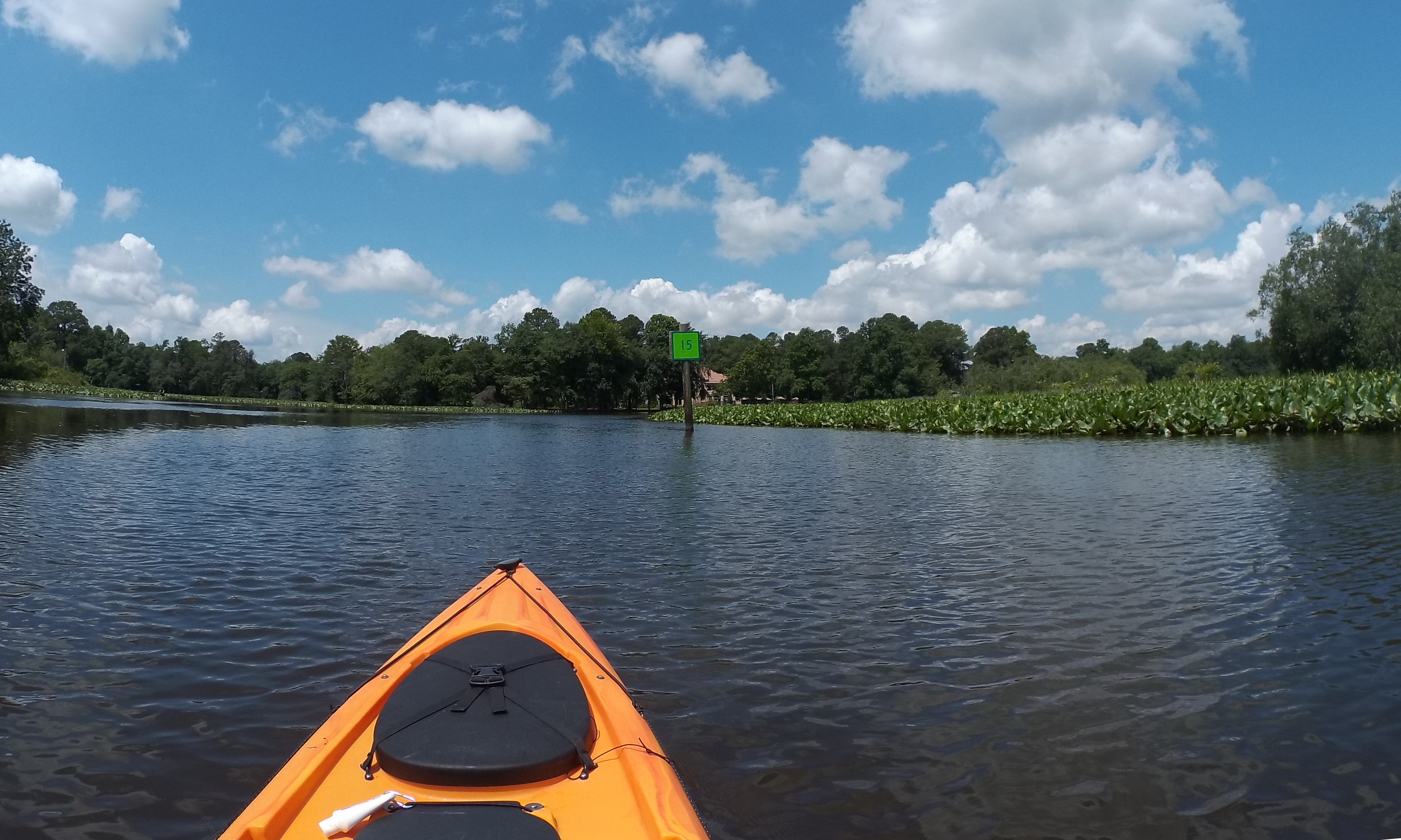 Ed Koch Area is across the creek from daymark 15 |
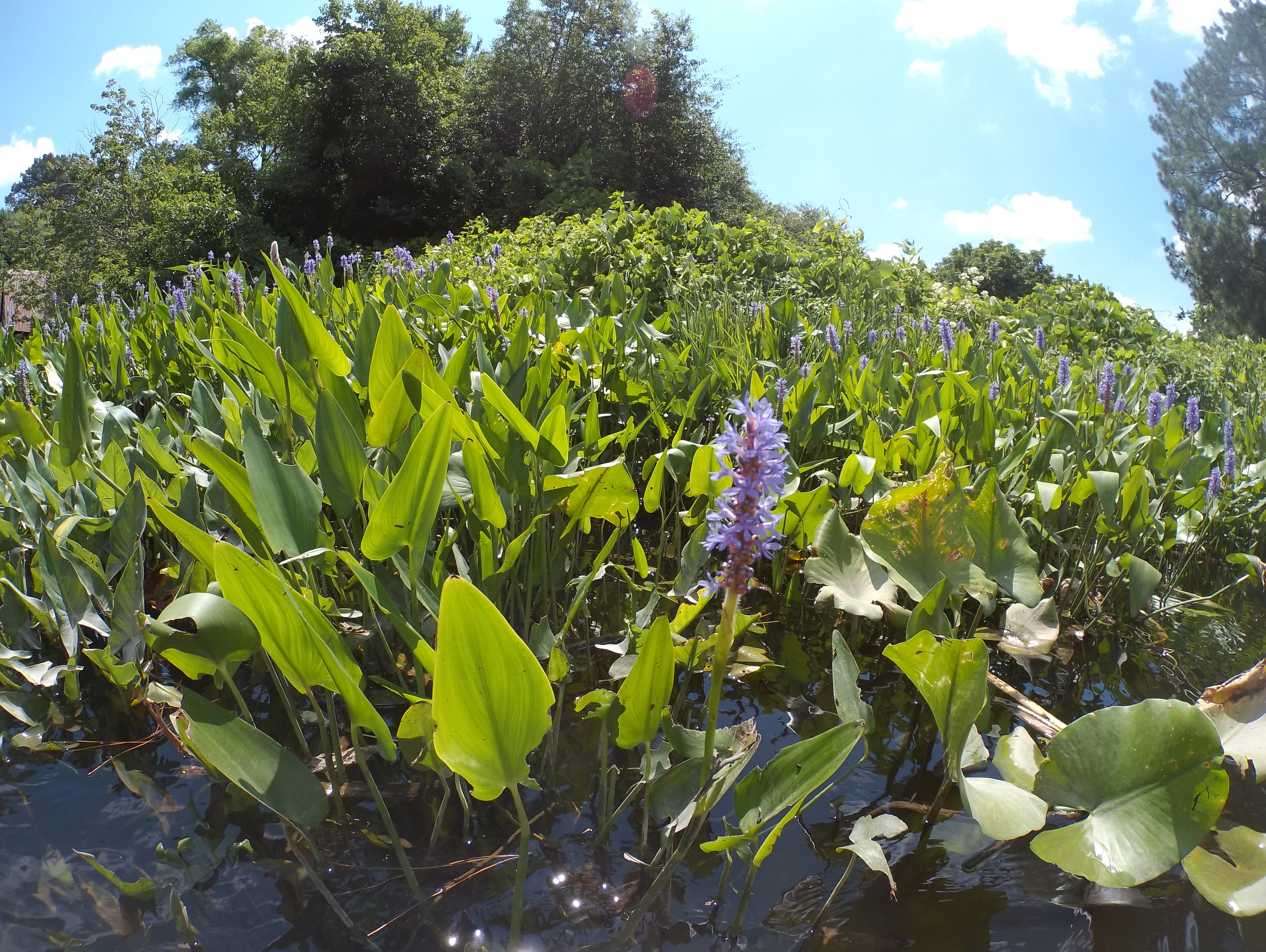 Pickerel weed is more prevalent on the middle and lower stretches of Broad Creek |
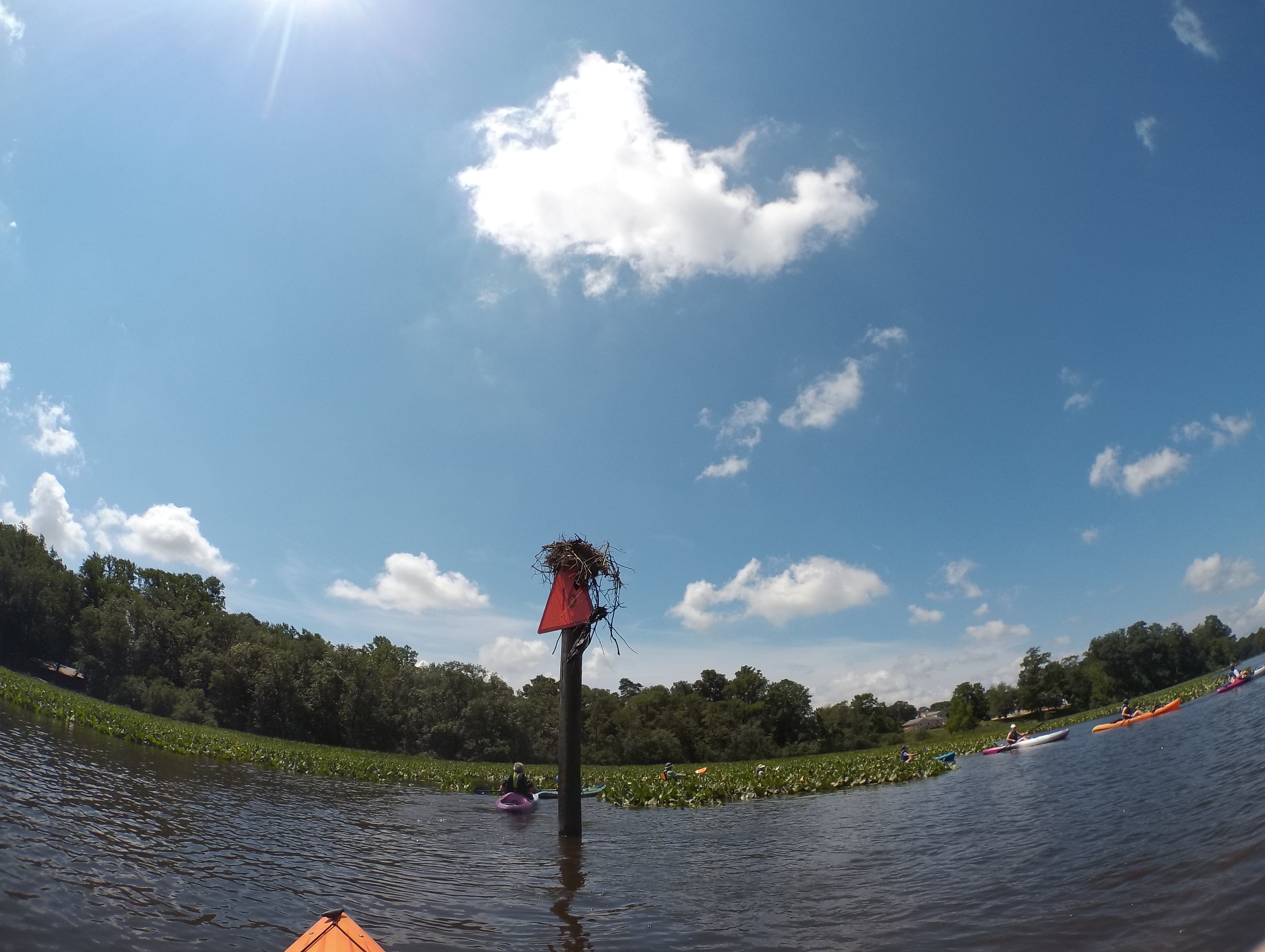 An Osprey nest at daymark 16. |
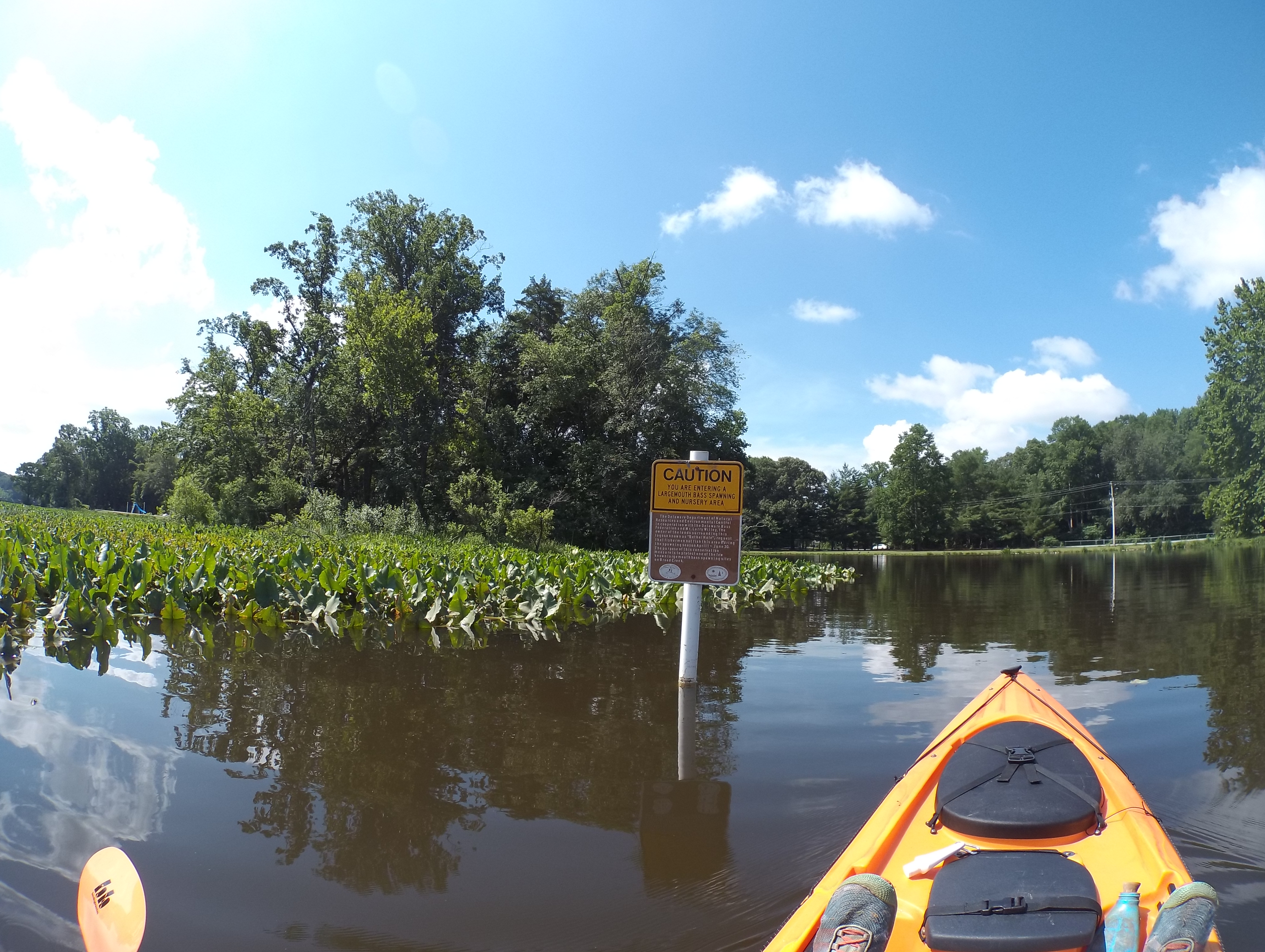 Bethel Hole is a largemouth bass nursery and is closed to fishing from April 1 to June 30. |